by Communications TEAM | Jun 13, 2024 | announcement, Minutes, News
Our April meeting minutes were approved at our last meeting and are now available to read in full by clicking here
At the meeting we discussed
- April Police report
- Kier Street Tennis Courts and MUGA
- Guala UCP Factory Site
- Sunnylaw Land Bid
- Local Place Plan
- Succession Planning/Vacancy
- Litter and Weeds
- Bank and Post Office
- Recycling bins
- Well Road – Alexander Drive Footpath
- Planning report
- Reports form our Chair, Secretary and Treasurer.
Minutes for the latest May meeting will be available after their approval at the next meeting. However news on the progress of projects and local issues will also be shared via our website and social media accounts, so sign up to our mailing list or follow us to find out our news.
Minutes from all our past meetings can be found on our meetings page

by Communications TEAM | May 27, 2024 | announcement, News
World Textile Day will be back in Bridge of Allan
Come along to the Parish Hall on Keir Street this Saturday – June 1st from 10 am to 4 pm.
World Textile Day Scotland has been running since 2012 and Diane and Magie the organisers have been at each and every one but this year they are retiring, and so this will be the very last World Textile Day organised by them. It will mark the end of a hugely enjoyable adventure.
In the morning at 11 am Gaynor Williams will be giving a talk called “Textile Animal Trappings – Celebration and Endurance” with lots of examples from her large collection of textiles which are used to decorate animals – donkeys, horses, cattle, camels and even elephants.
In the afternoon at 2pm there will be two short talks. The first by Magie Relph will be a look back on her textile career with “A funny thing happened on the way to the market: Africa, fabrics and life on the road”. This will be followed by Diane Gaffney’s talk about one of her very favourite places to shop “From the Artisans of Java to the Quilters of Scotland – the story of Bali Batiks”.
Fair Trade Market
The traders are Susan Briscoe (Japanese sashiko, threads and fabrics), The African Fabric Shop (batik, beads and baskets), Textile Traders (clothes, ikats, batiks and jewellery from SE Asia), The Nomad’s Tent of Edinburgh – world famous traders in rugs and textiles, John and Joan Fisher with their amazing collection of Egyptian appliqued tent hangings Karen Haggis with wonderful Textiles of Nepal, Rosalind Johansson from Orkney with lovely Peruvian textiles and Jim Gaffney with his Textile Treasures (antique and collectible treasures)
Tickets for the talks will be available on the door.
The local WI will be providing plentiful refreshments throughout the day.
The organisers Diane and Magie say “As always we will have an array of wonderful textiles from many parts of the world for sale. Come and enjoy this very special small show with textile experts on hand to answer any questions you may have and to tempt you with a fantastic market place of clothes, textiles, fabrics, tools, beads and much more. World Textile Days are always a great opportunity to meet up once a year with your fabric loving friends. Sit down, have a cup of tea and a chat and enjoy shopping for some unique finds.”
More info at www.worldtextileday.co.uk
Photo by analuisa gamboa on Unsplash

by Amanda Coulthard | May 20, 2024 | announcement, News
We are looking for a new member to join the Community Council as co-opted members and help out with a range of projects, and are particularly interested to hear from you if you have skills in social media and communications, fundraising, digital and IT, or community organising.
The Community Council actively work on many different community projects and initiatives, with other groups in the area like Friends of Bridge of Allan and the development Trust – Discover Bridge of Allan. It is more important than ever that all sections and voices of Bridge of Allan are represented on the Community Council. There are 10 public meetings a year usually held at the Allan Centre.
To see what we have been working on recently you can look at past meeting minutes and our Facebook page. To find out more about community councils and how they are run see the Stirling Council Community Council Handbook.
You can put yourself forward if you live in the Bridge of Allan area, are over 16, and are on the electoral register. To nominate yourself you should complete this Co-option Nomination form and return it to contact@ccbridgeofallan.org.uk by June 7th.
Nominations will then be voted on and approved at our June meeting. If you’re not sure and want to chat to one of us then please get in touch.
Icons by https://icons8.com

by Communications TEAM | May 19, 2024 | announcement, News, Planning
Julie the Community Ranger from Edinburgh University has been in touch to update us on the woodland creation at Drumbrae and offer some volunteering opportunities.
Firstly an update on the University of Edinburgh’s woodland creation plan at Drumbrae.
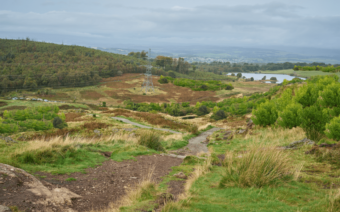
The University of Edinburgh have been working to develop new woodland creation proposals for Drumbrae, near Bridge of Allan.
Many of you may have already provided comments on the draft design as part of earlier local engagement work which included a drop-in event in Bridge of Allan and on-line consultations. To view a summary of these results, visit their website: Drumbrae | The University of Edinburgh.
This engagement was part of their Scottish Forestry’s Woodland Creation Application process. The University have submitted a Forestry Grant Scheme (FGS) application to Scottish Forestry to secure funding for this new planting. You can see the design in the image.
drumbrae_design_v5
The application is now on the Scottish Forestry Public Register of Felling Permission and Forestry Grant Scheme Applications, and available for any final comments to be made directly to Scottish Forestry. This can be done online via the Public Register or by contacting Scottish Forestry directly via email: panda.cons@forestry.gov.scot or Tel: 03000676005. The application will be available for comment on the Public Register until the 6th June 2024.
Volunteering opportunities
During June and July the University will be running 4 conservation volunteer days at Drumbrae.
Working alongside local crafts people task will improve the well-loved path to Dumyat from Sheriffmuir Road. This is a great opportunity to get involved, learn new skills, meet new people and help maintain the path for everyone to enjoy. There will be a variety of tasks including digging ditches, clearing drainage features, path surfacing and rebuilding a section of dry stone wall.
The volunteer days will run from 10am-3pm and the dates are:
- Thursday 13th June
- Saturday 29th June
- Wednesday 3rd July
- Friday 12th July
More information is available on their website: Volunteering opportunities | The University of Edinburgh. You can also find out more about our plans for Drumbrae here.
If you are interested in taking part, please visit the website where there is an online form to register.
A4 2024 conservation volunteering - compressed

by Communications TEAM | May 19, 2024 | announcement, News
Our next Community Council meeting will be held on Tuesday 21st May in the Allan Centre GP room.
The meeting starts at 7.30pm and any member of the public is welcome to attend. We will be joined by people and organisations that work together for the people of Bridge of Allan, the community policing team, Friends of Bridge of Allan and elected representatives when their calender permits.

by Communications TEAM | May 6, 2024 | announcement, News
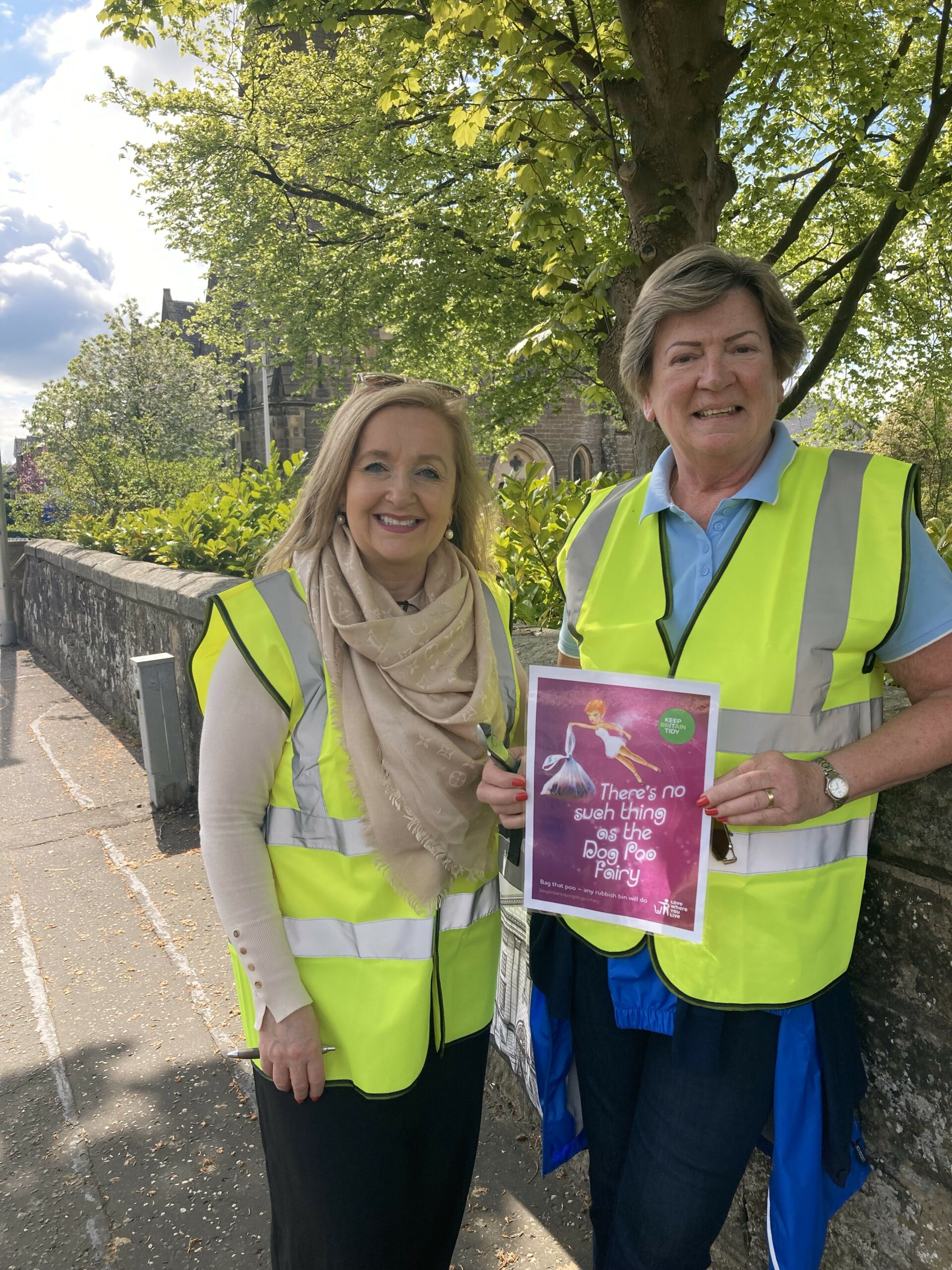
Dear residents we need your help to work together to stop dog fouling.
We are launching our second campaign in three years and need your help. Following on from the S*Hit Squad campaign back in 2021 where children from Lecropt Nursery designed posters, and many residents were involved in placing and stocking bag dispensers around the village. However the issue of people not picking up after their dog continues to be an issue that frustrates many residents who get in touch with us.
We have spoken to the local dog warden to ask advice after complaints from residents. They are keen to help us as a community tackle this and suggested a poster campaign is a good start.
We are hoping that a playful reminder to those out walking their dog to pick up from the mythical Dog Poo Fairy will encourage them to be responsible. So look out for these posters going up around the village.
Are there target areas you think this reminder is most needed? Do you sometimes get caught short without a bag? If you notice an area with problematic dog fouling you can report it to Stirling Council using
this online form
So if you have an issue with dog fouling on your street, or you have any suggestions on what can be done to stop this, we’d love to hear from you.


